Update History
San Diego Trail Map - October 2013
In preparation for the upcoming desert season...
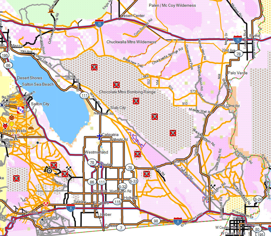
Coverage Area Extended East to Arizona Border
The map now includes all of Imperial County and southern parts of Riverside County.
Coverage area now includes:
- Cargo Muchacho Mountains
- Chuckwalla Mountains Wilderness
- Cibola National Wildlife Refuge
- Desert Center
- East Mesa
- Ferguson Lake
- Glamis
- Gordon Wells
- Imperial National Wildlife Refuge
- Imperial Sand Dunes
- Indian Pass
- Little Chuckwalla Mountains Wilderness
- Martinez Lake
- Mecca Hills Wilderness
- Ococopia Mountains Wilderness
- Painted Canyon
- Palo Verde Mountains Wilderness
- Picacho State Recreation Area
- Senator Wash
OHV trails have increased from 1,135 miles to 3,700 miles.
Street legal dirt roads have increased from 1,860 miles to 2,700.
Updates to Existing Coverage Area
Changes to the Otay Mountains Wilderness and Marron Valley area plan have been deferred
until 2014. I've done extensive "field research" in the area and discovered some
trails that have been unofficially closed in the interim. The map for this area
are current and will be updated when the plan for area is officially changed.
Increased map coverage of BLM lands and publicly accessible dirt roads south of
highway 94 to the border.
Added hiking and horseback trails to the Beauty Mountains Wilderness area.
Coverage area is now identical to Garmin version.
Topo version is not available due to technical constraints related to the size of
the map.
Some of the detail included with the Garmin map is not included with the Lowrance
map due to hardware limitations. This is mostly limited to custom graphics and points
of interest such as gas stations, ATMs or restaurants that are searchable with the
Garmin version.
